


Kirsten Anderberg's URBAN ADVENTURES: Anacapa Island, Ventura County, CA
Anacapa is approximately 11 miles from the mainland at Oxnard and 17 miles from Ventura. It is located in Ventura County. Anacapa Island is approximately 5 miles long and 1/4 - 1/2 mile
wide. It is composed of three "islets;" East, Middle and West Anacapa. The highest peak on Anacapa is 930 feet at Summit Peak on West Anacapa. Anacapa is the second smallest island of the
Channel Islands, the smallest being Santa Barbara Island. The island has been named "Anacapa" on maps since the early 1790's, and was named that on George Vancouver's maps of the area.
(Marla Daily, California's Channel Islands: 1001 Questions Answered, 1987, McNally and Loftin, Santa Barbara, CA.) Stay tuned...I am building this page and new content will be posted shortly.
I am researching and writing a book about Anacapa Island. I have written a book about Santa Cruz Island and
plan to write books about all the Channel Islands in time.
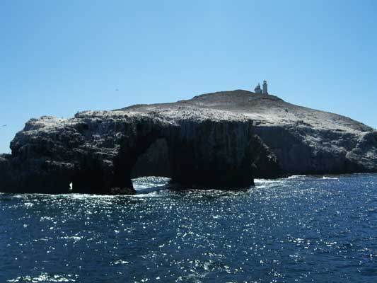 Arch Rock on eastern side of Anacapa Island. Photo taken facing west. Notice light shining through the cave/tunnel that is passable in a kayak on the left side of the Arch Rock. There is also a small tunnel/cave in the right side too. (Photo: K. Anderberg, Aug. 2009)
Thank you to Resist.ca for hosting this website!